Importing Height Map Guide
This document provides a comprehensive guide to how to use your own custom height map in OCG.
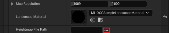
1. Press … on Heightmap File Path
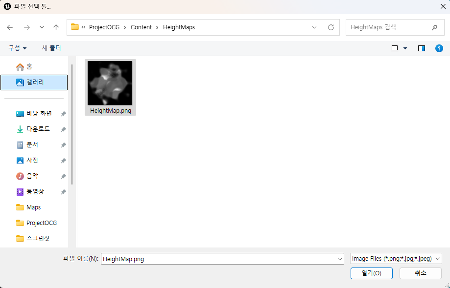
2. Find the height map file you want to import and double click
- Map resolution will be automatically changed as the resolution of the image imported.
Do not change map resolution after you have imported height map.
This will result in unexpected result.
3. Press Generate Button and landscape will be generated based on the height map imported!
- If you want to see preview landscape press Preview Maps button. This will show the expected landscape with green lines.